Bursa Setbaşı, Yeşil and Emirsultan Historical Axis
Osman Can Bagatır
Ece Kandemir
Hüsna Nur Pehlivan
Emre Eren Özaşık
Gülfem Keskinkılınç Subaşı (City Planner)
Almira Endican (Landscape Architect)
Visualization:
Halil İbrahim Zeytinci
Renders
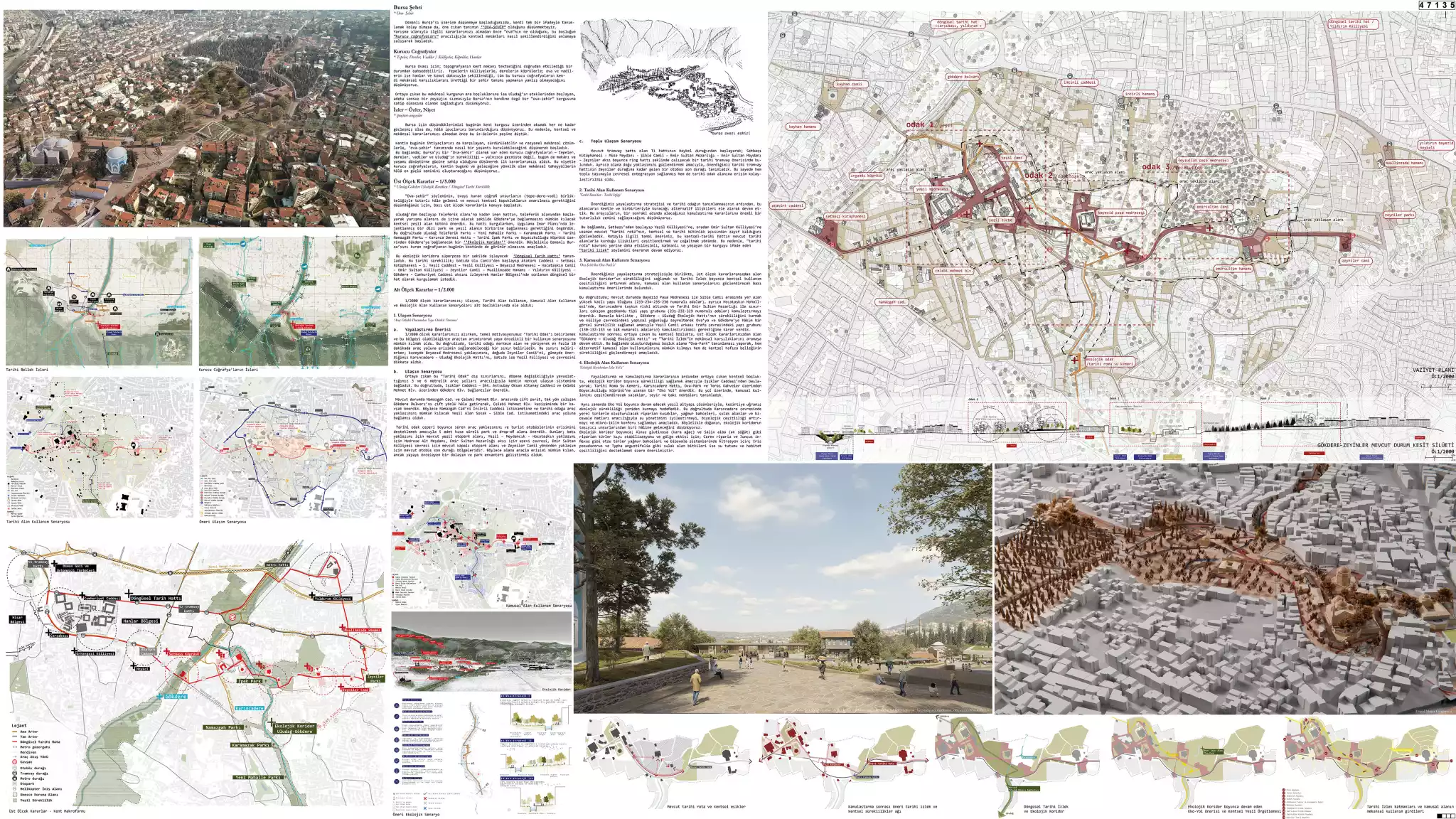
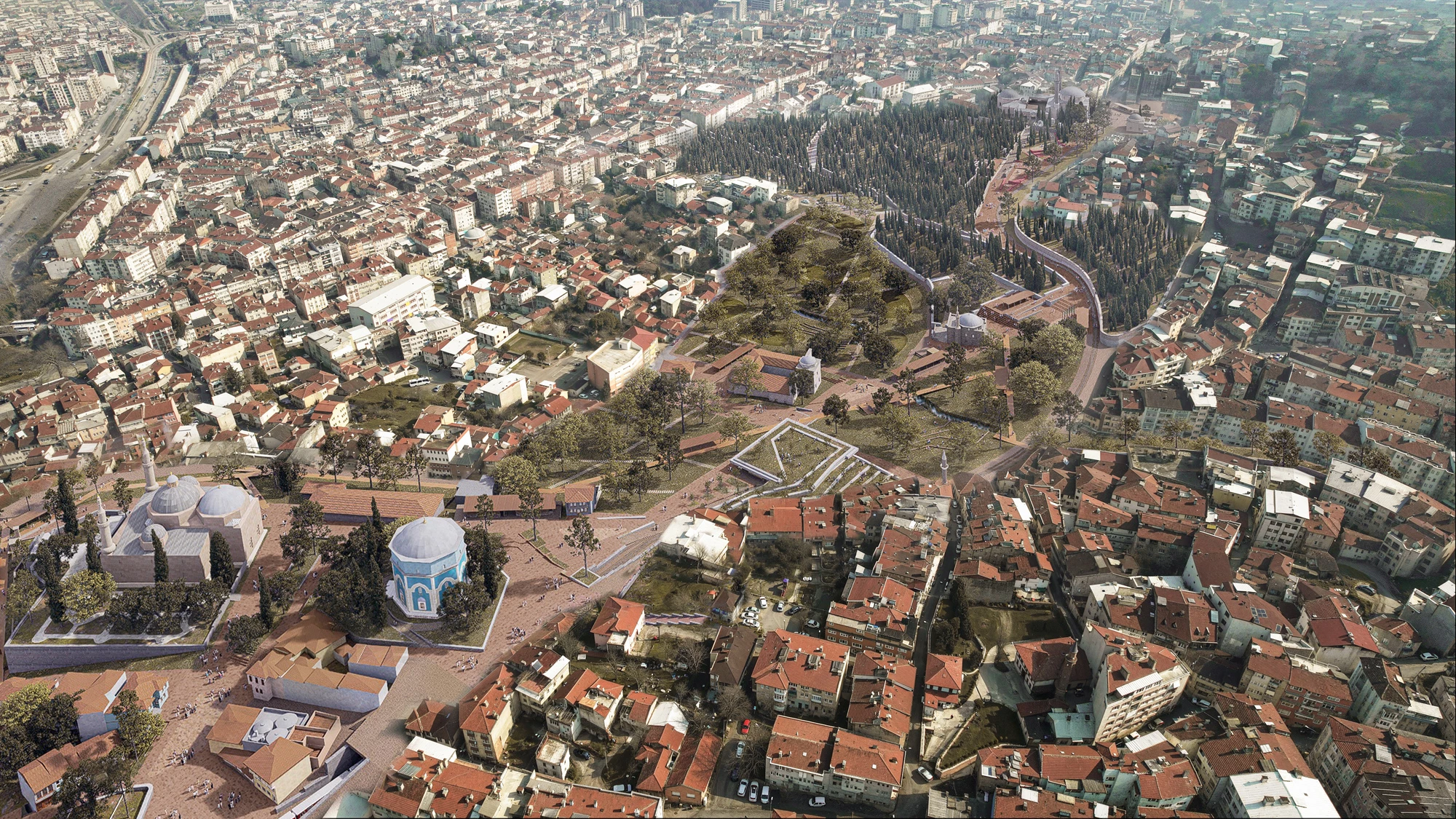
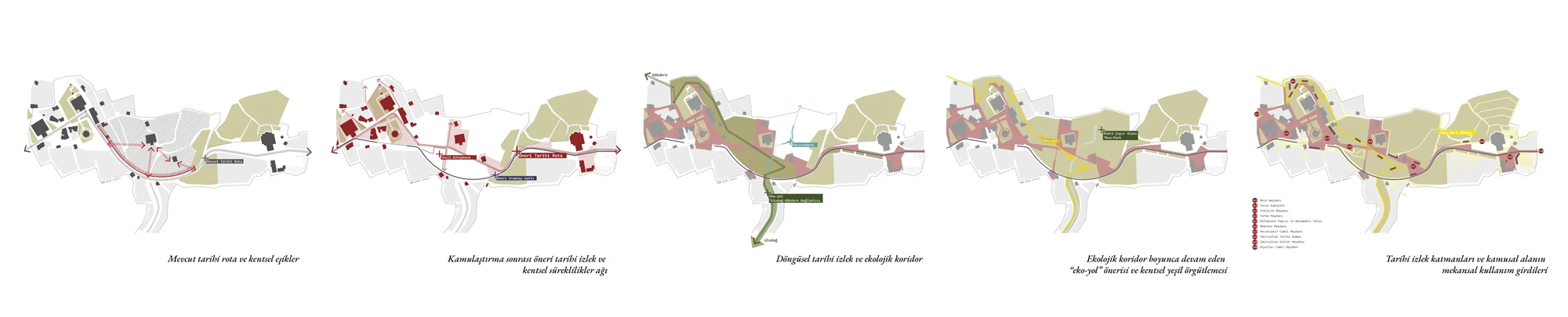
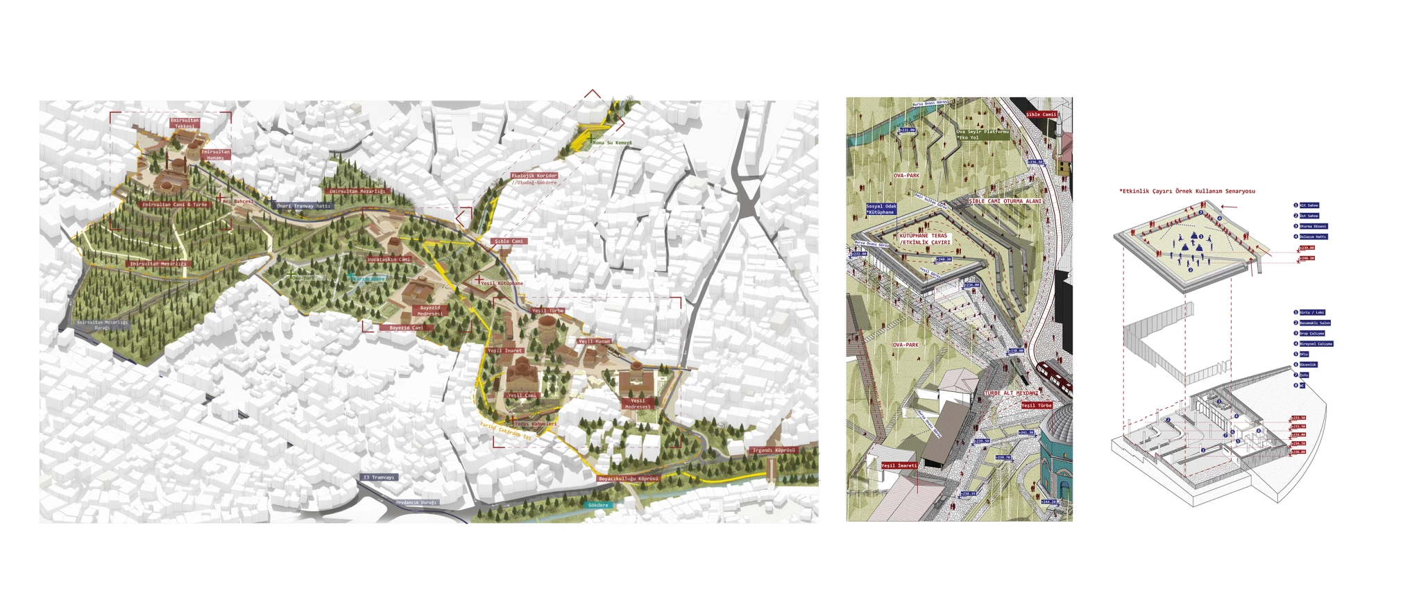
From ‘Historical Route’ to ‘Historical Trajectory’
Following the definition of the pedestrianization strategy and the historical focus we proposed, we continued by considering alternative relationships these areas will establish with the city and with each other. We believe that these explorations will provide an important basis for consistency in the expropriation decisions we will make in the next step.
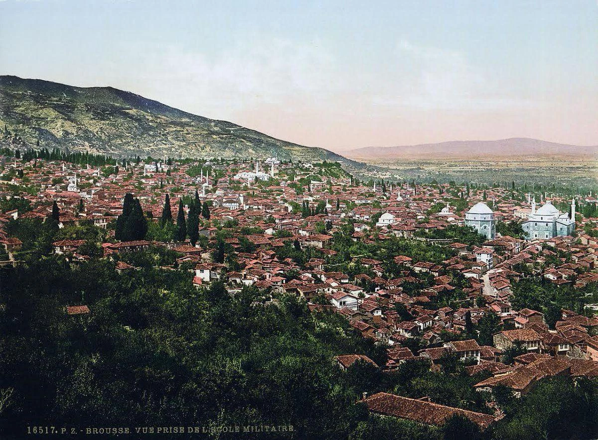
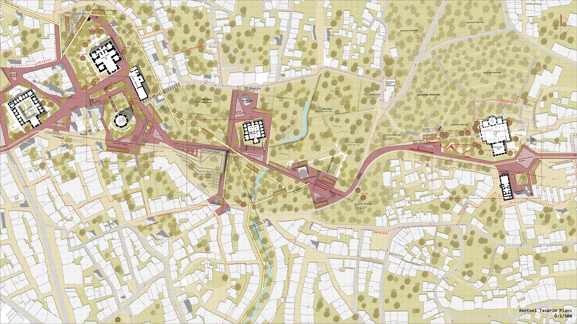
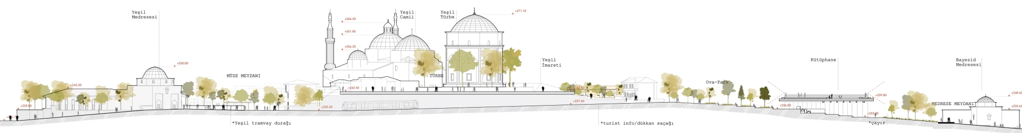
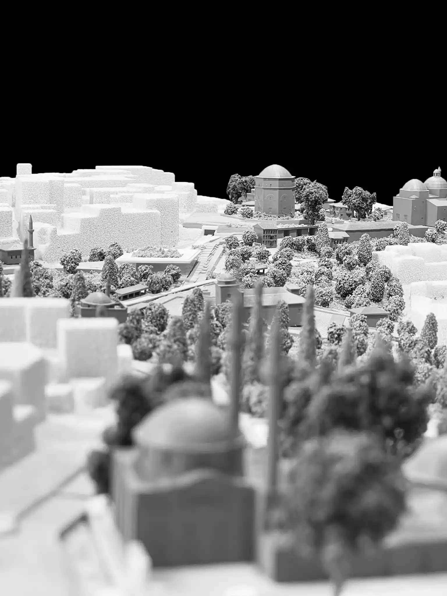
In this context, we observed that the existing “historical route,” starting from Setbaşı and extending to Yeşil Külliyesi and then to Emir Sultan Külliyesi, is weak in terms of urban and historical integrity. Our main proposal regarding the route is to diversify and increase the relationships that this urban-historical line establishes with existing historical areas. Therefore, instead of the concept of “historical route,” we are proposing the discourse of “historical trajectory,” which expresses a more interactive, layered, and living narrative.
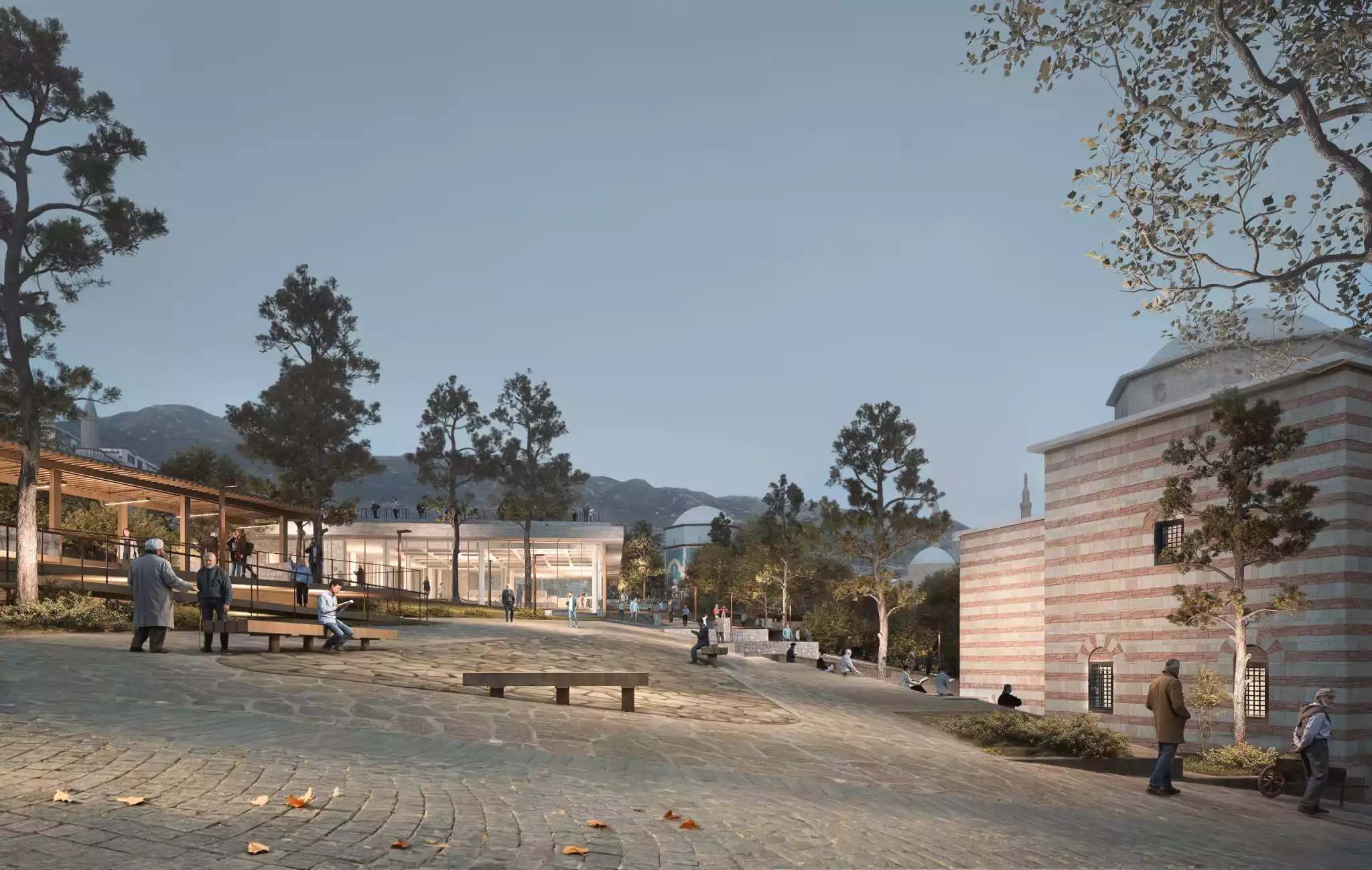
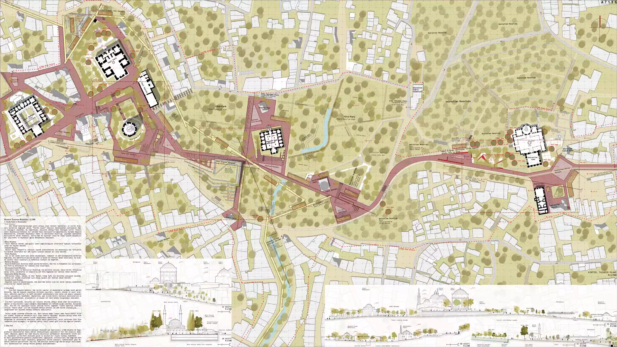
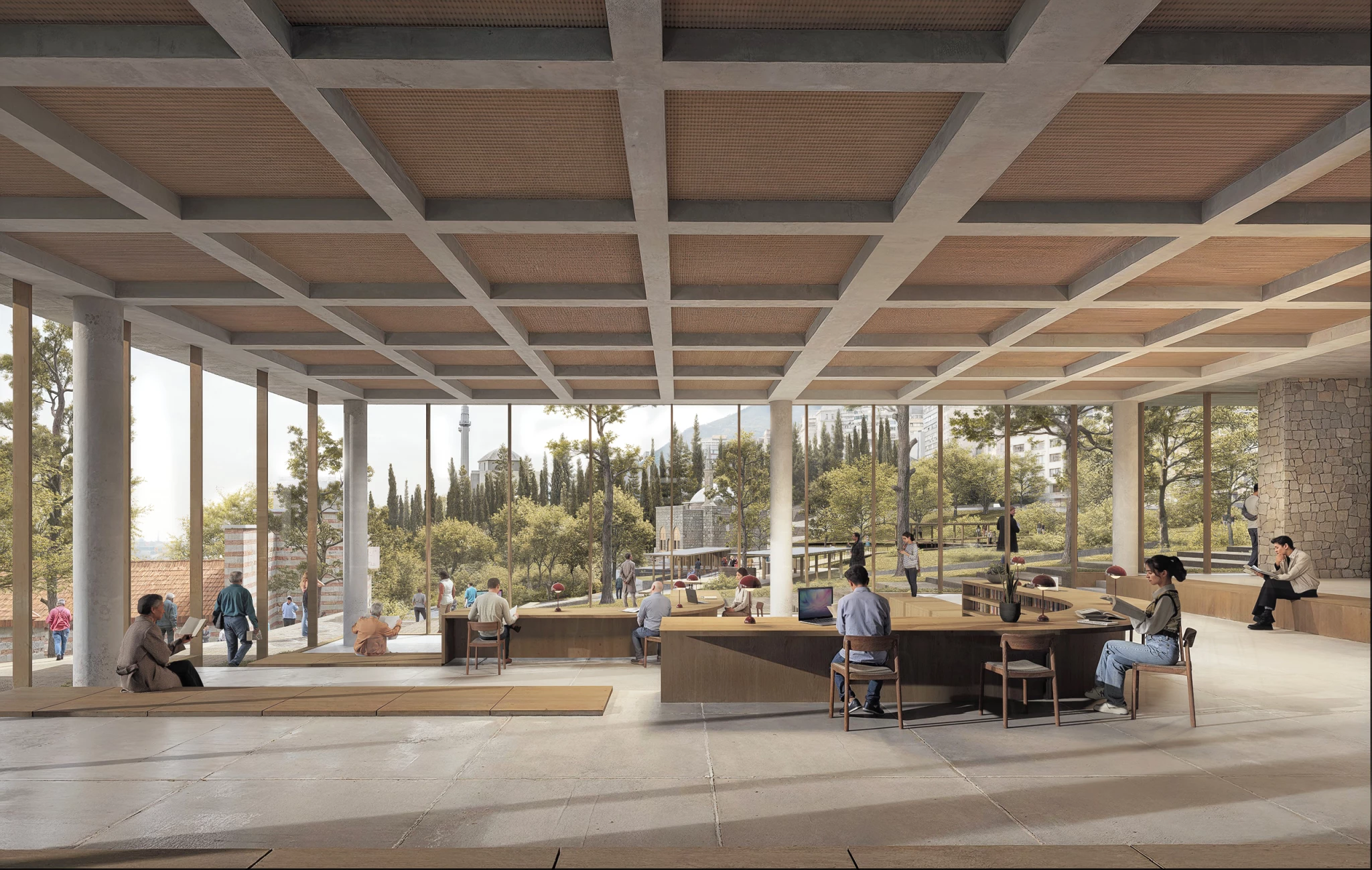
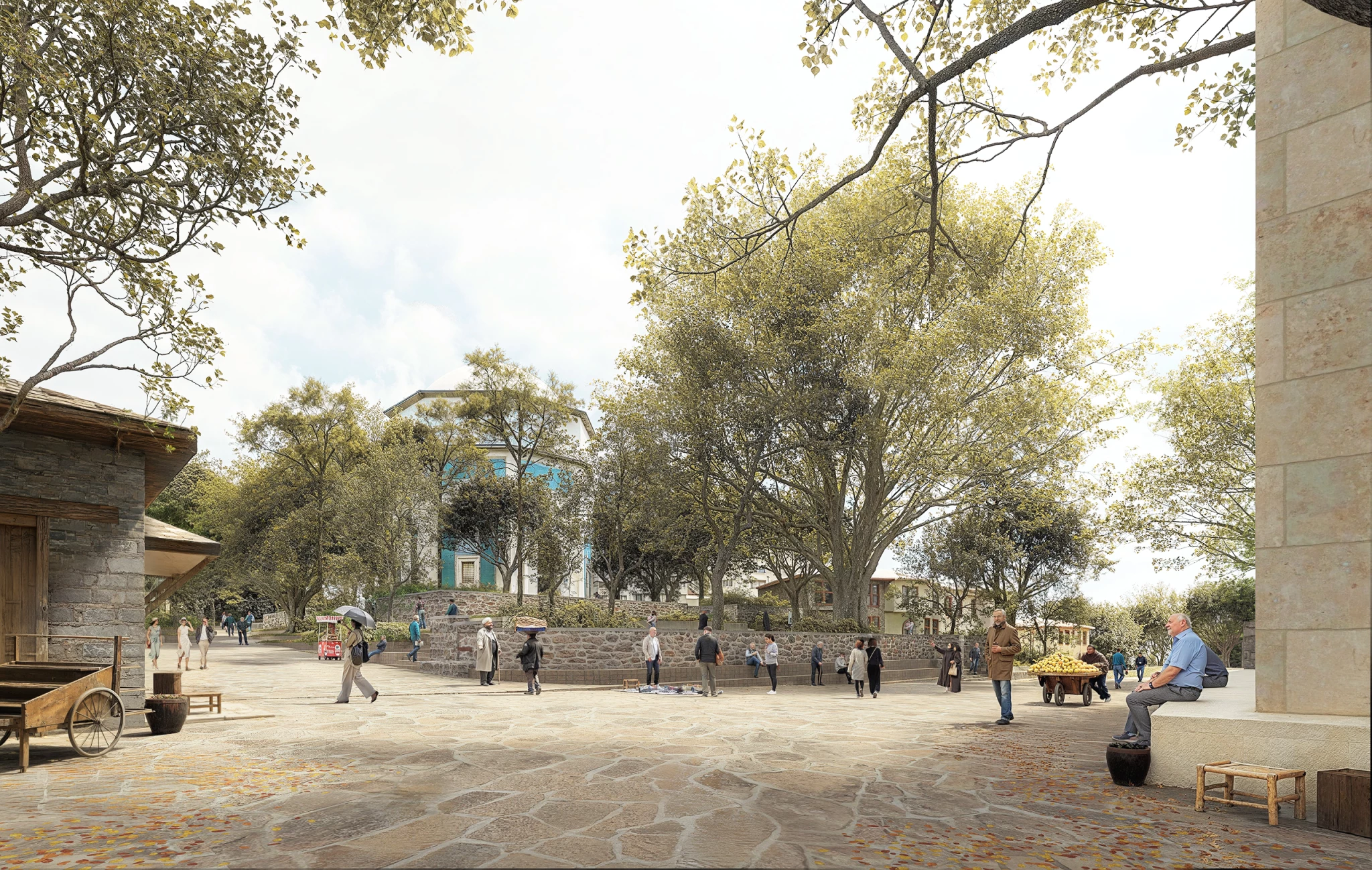
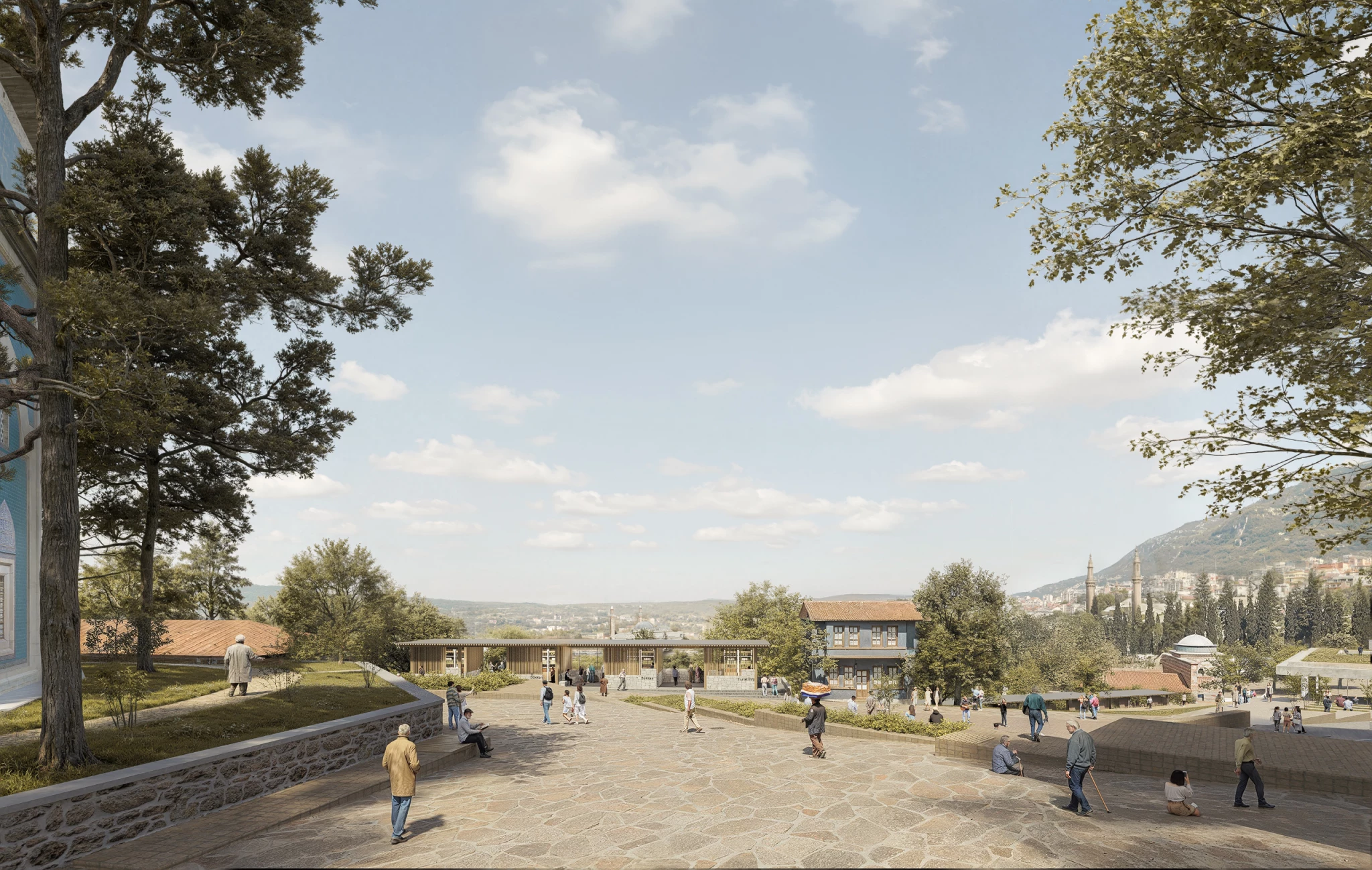
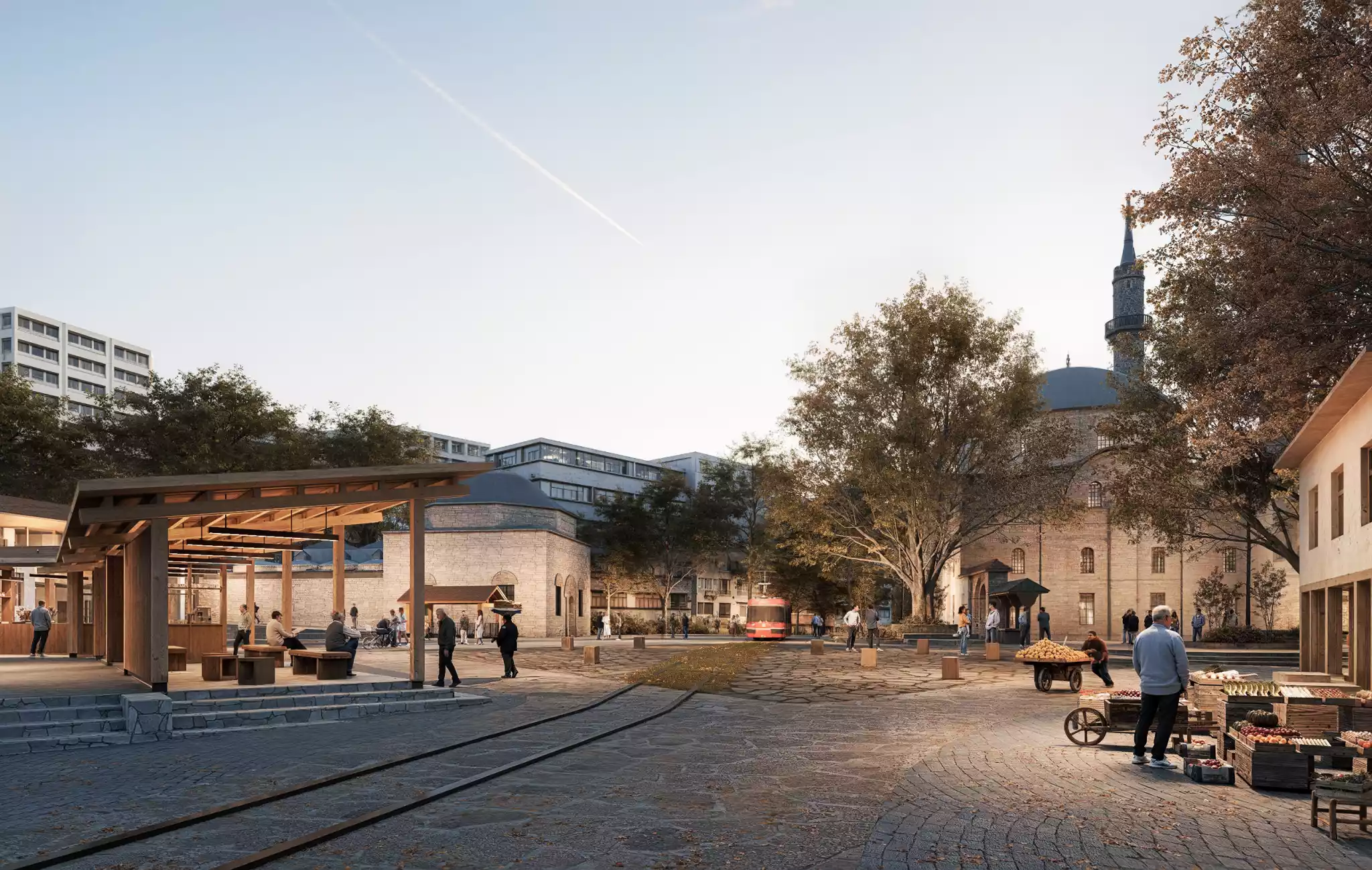
‘Historical Squares’
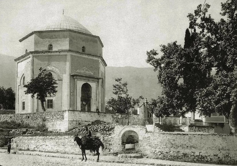
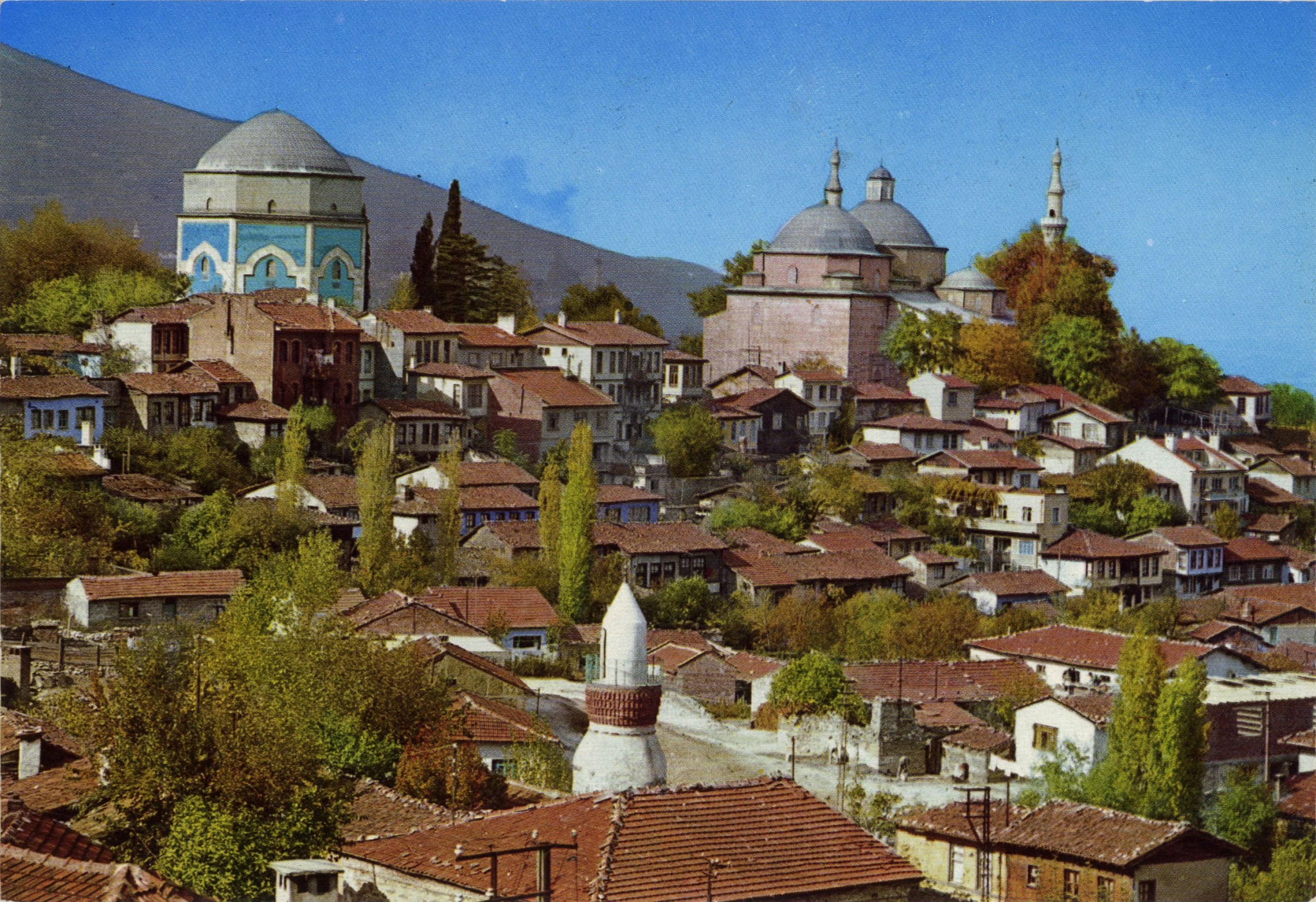
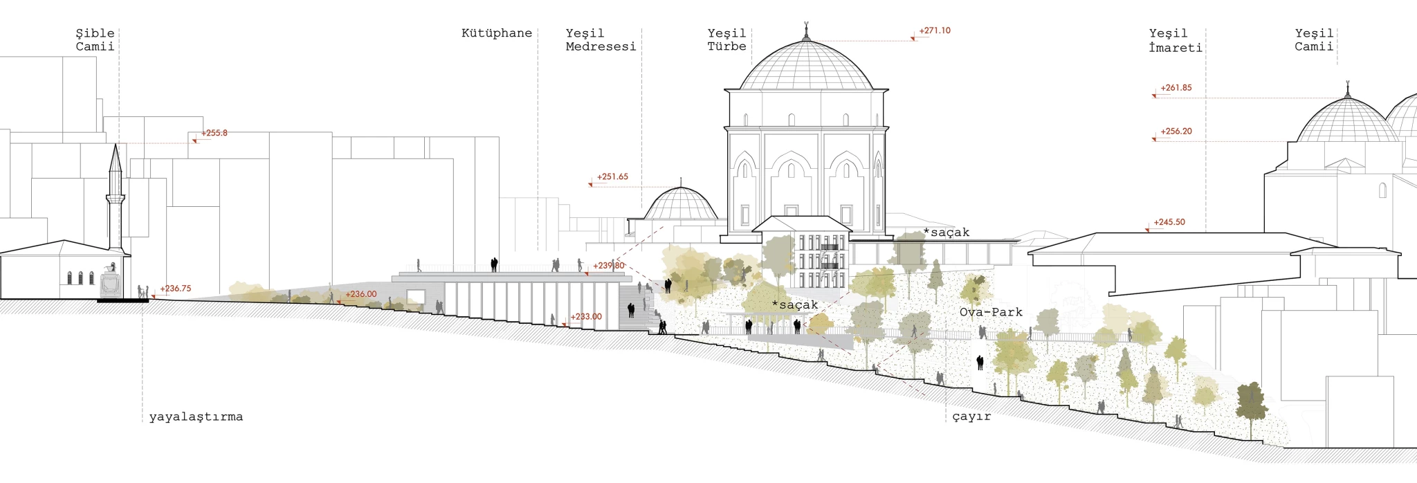
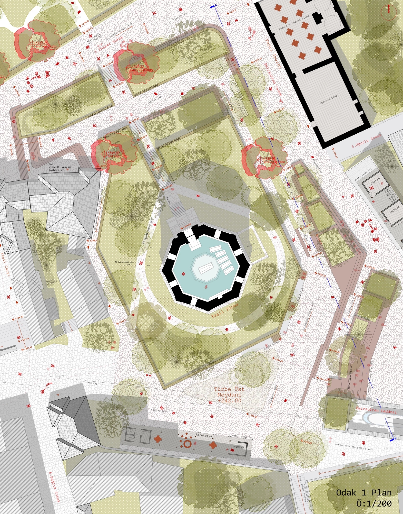
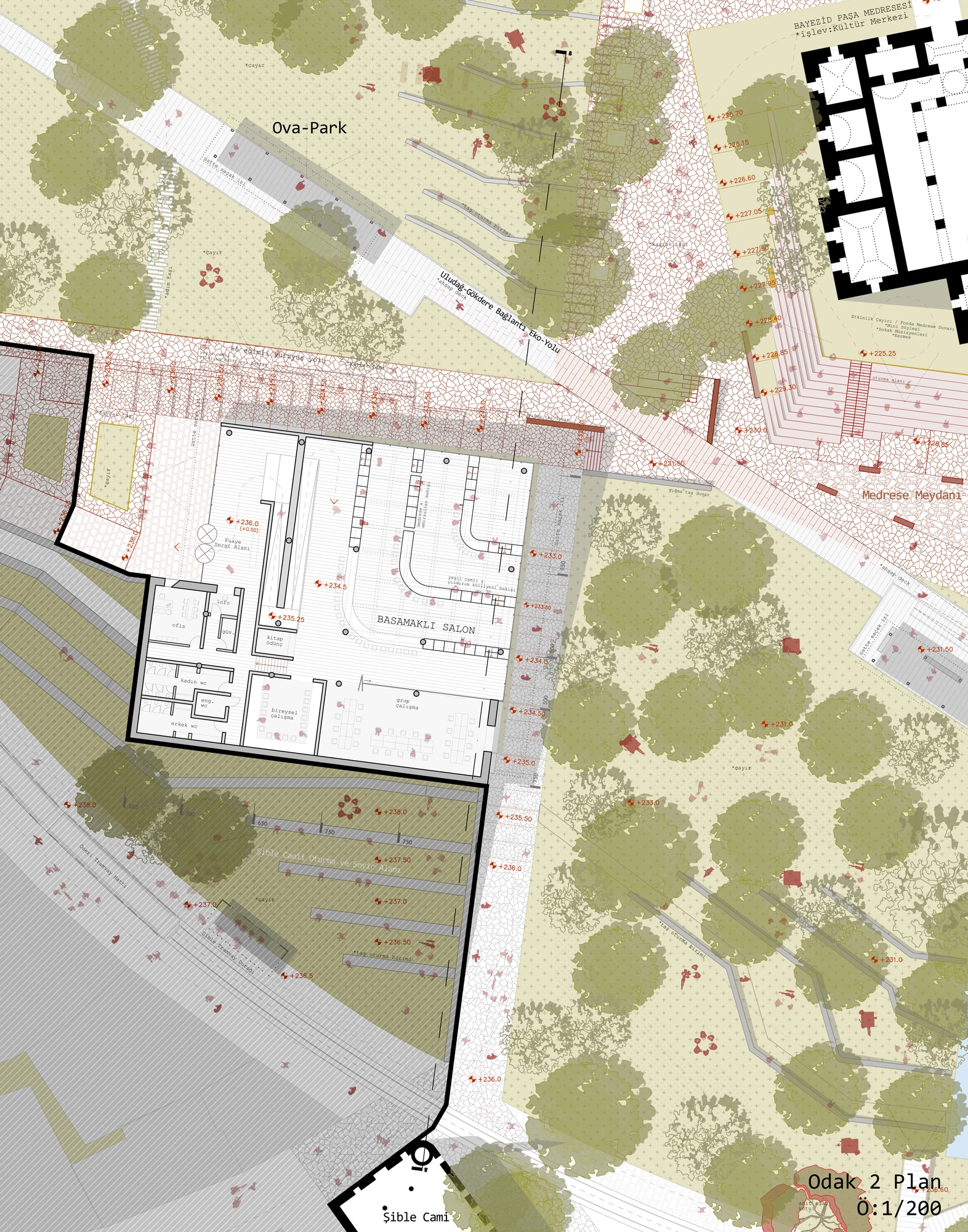
In order to connect the urban voids and historical areas that emerged after our large-scale decisions, we thought it would be appropriate to proceed by defining the “Historical Trail”. Accordingly, we aimed to connect the existing historical route, starting from Setbaşı, to the Yeşil Külliyesi with a holistic pavement; from there to the Bayezid Medrese, then to the Hocataşkın Mosque and Emirsultan Cemetery, to the Emirsultan Külliyesi; and finally to the Zeyniler Mosque, transforming it into an uninterrupted pedestrian path and network of squares.
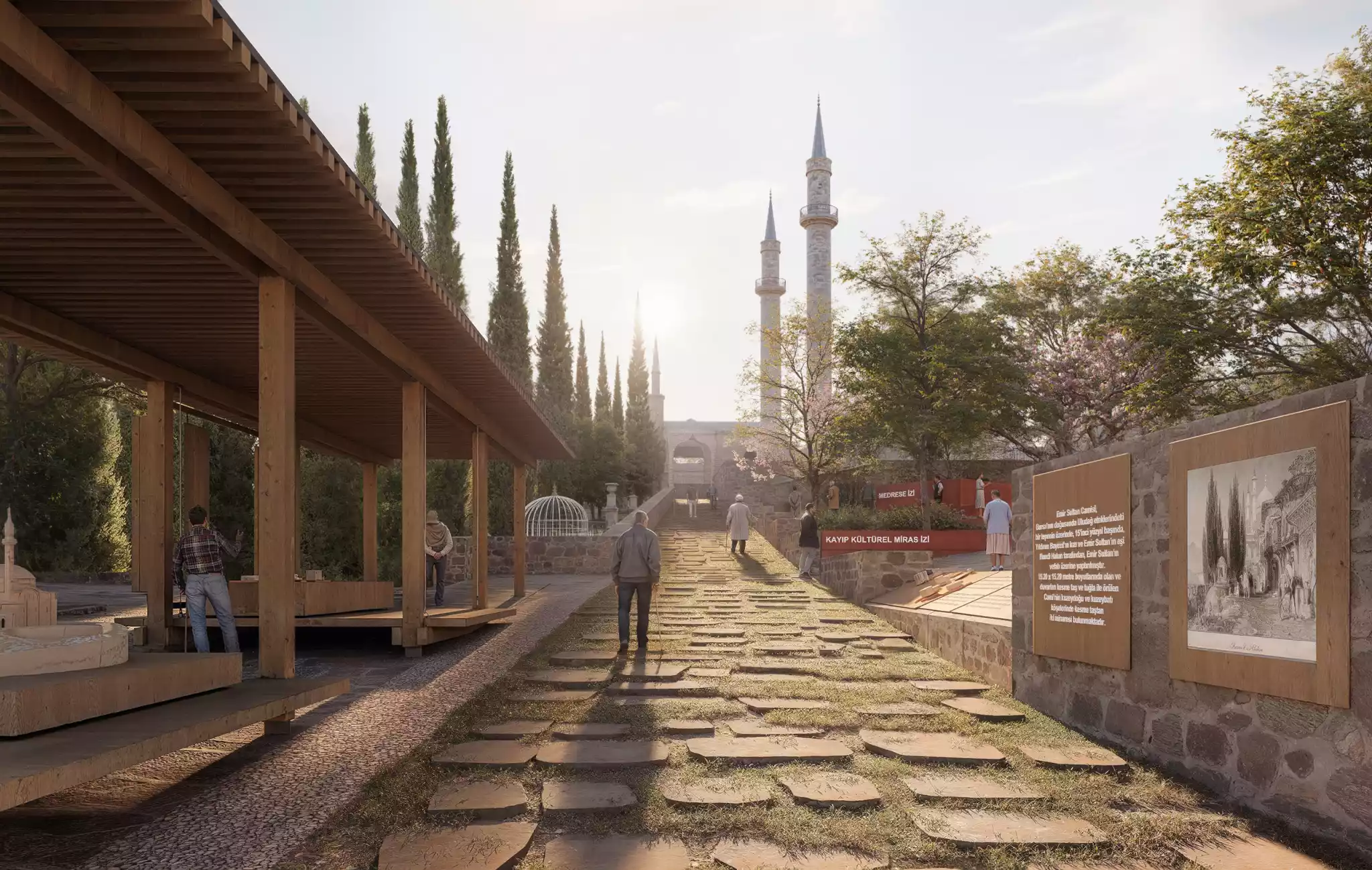
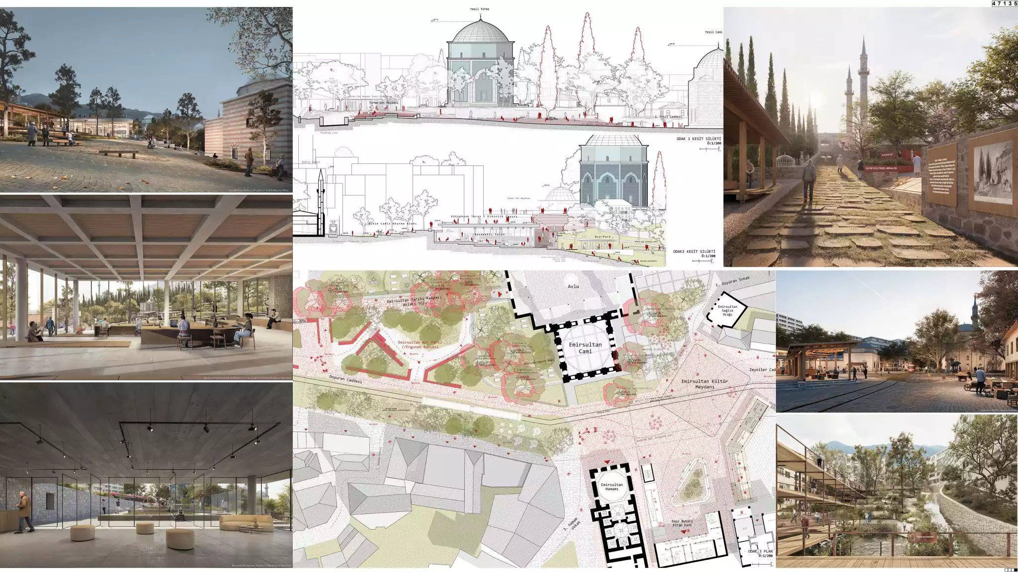
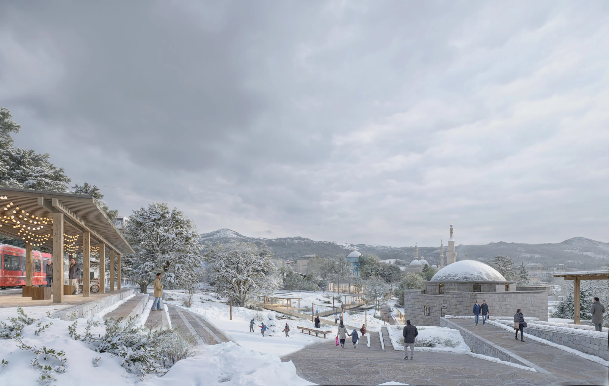
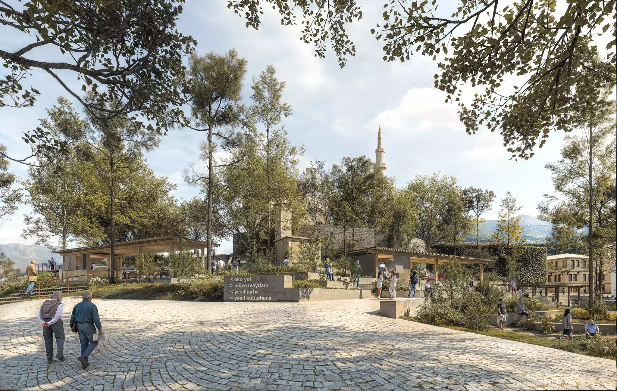
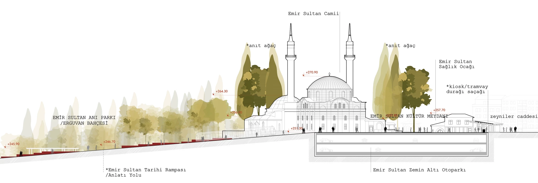
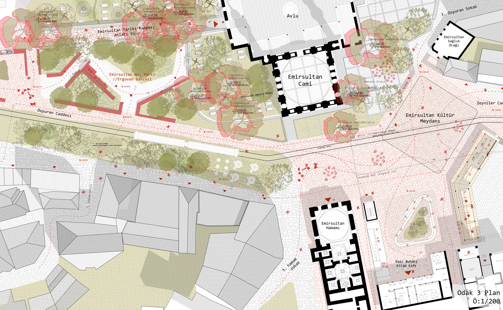
Historic Ramp - Memorial Garden - Emir Sultan Cultural Square
We transformed the historic ramp leading to the Emirsultan Mosque into a "narrative path" by proposing a change in its paving. In the triangular area along this path, we designed a "memorial garden" incorporating the walls and traces of the Cezeri Madrasa and other historical structures that were demolished during the road construction. In this garden, we included representative plants such as Cercis siliquastrum (Judas tree), Cornus mas (Dogwood), and Prunus dulcis (Almond), providing seasonal color, accent, and subtle fragrance.
Around the Emirsultan Complex, we aimed to transform the area, which has become detached from the scale due to the existing urban transformation, into a more human-scale cultural square by designing a wooden canopy to define the space.
©oliworks2025
Context
Drawings
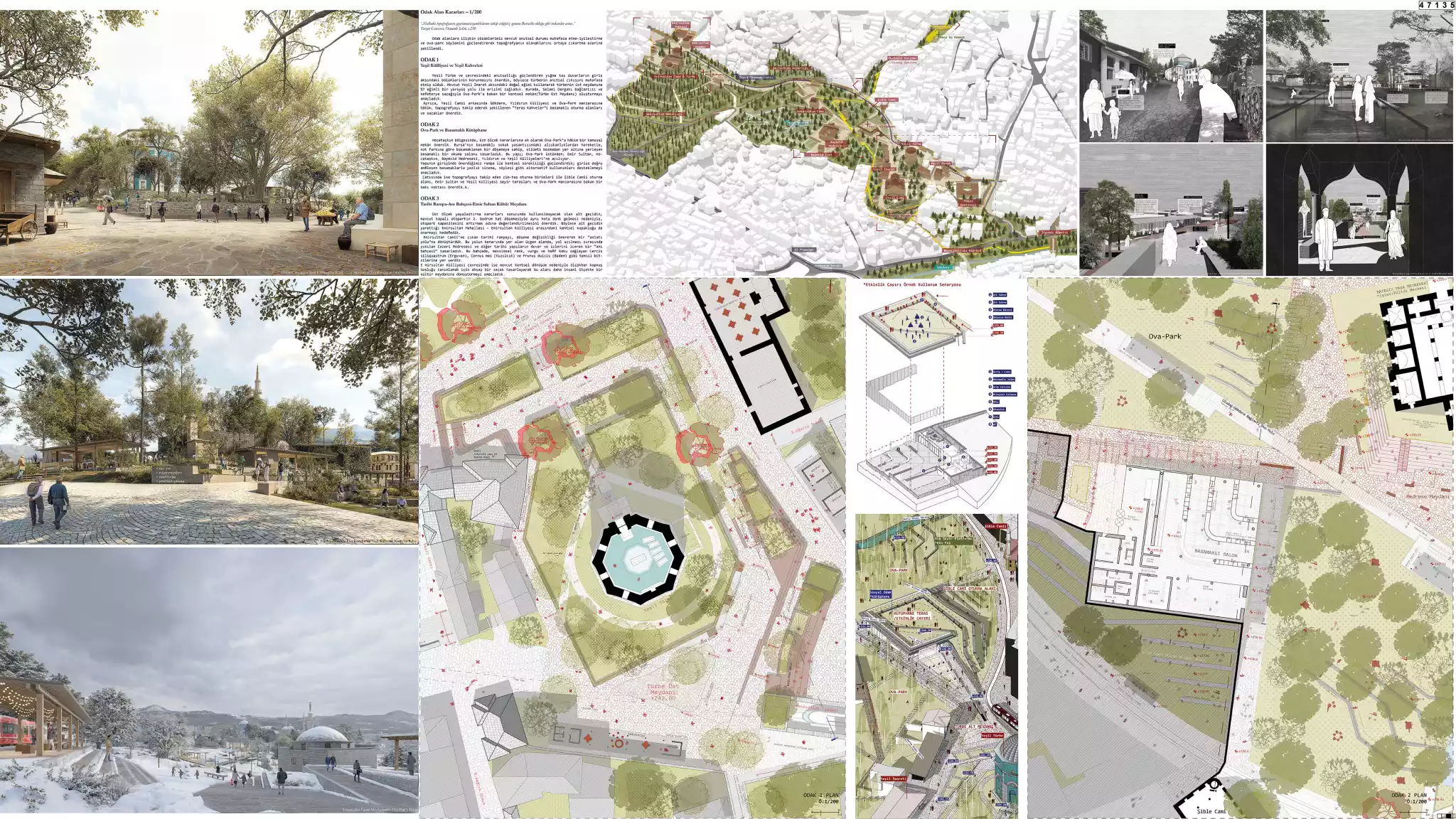
Focus Areas
Animation Clip
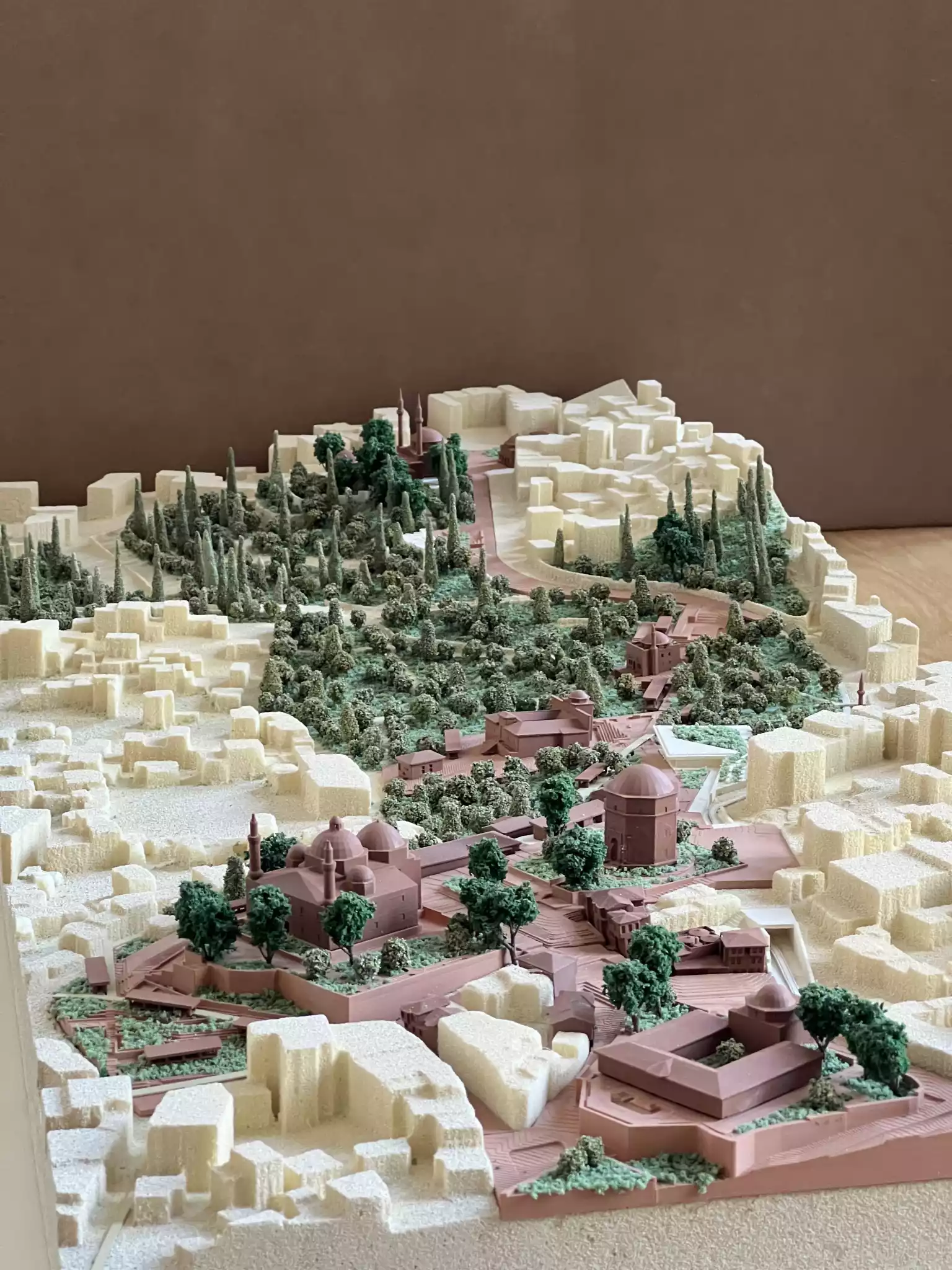
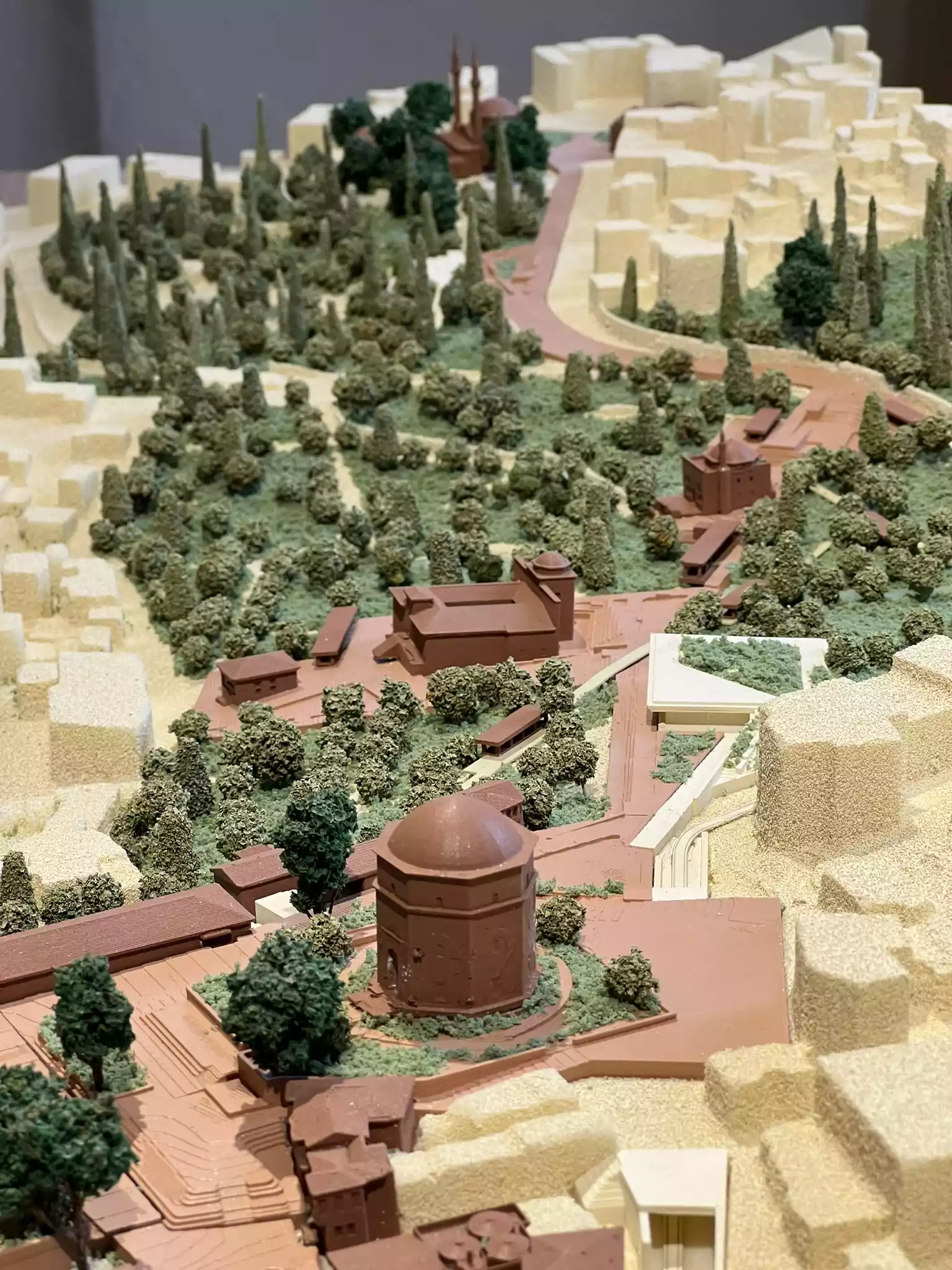
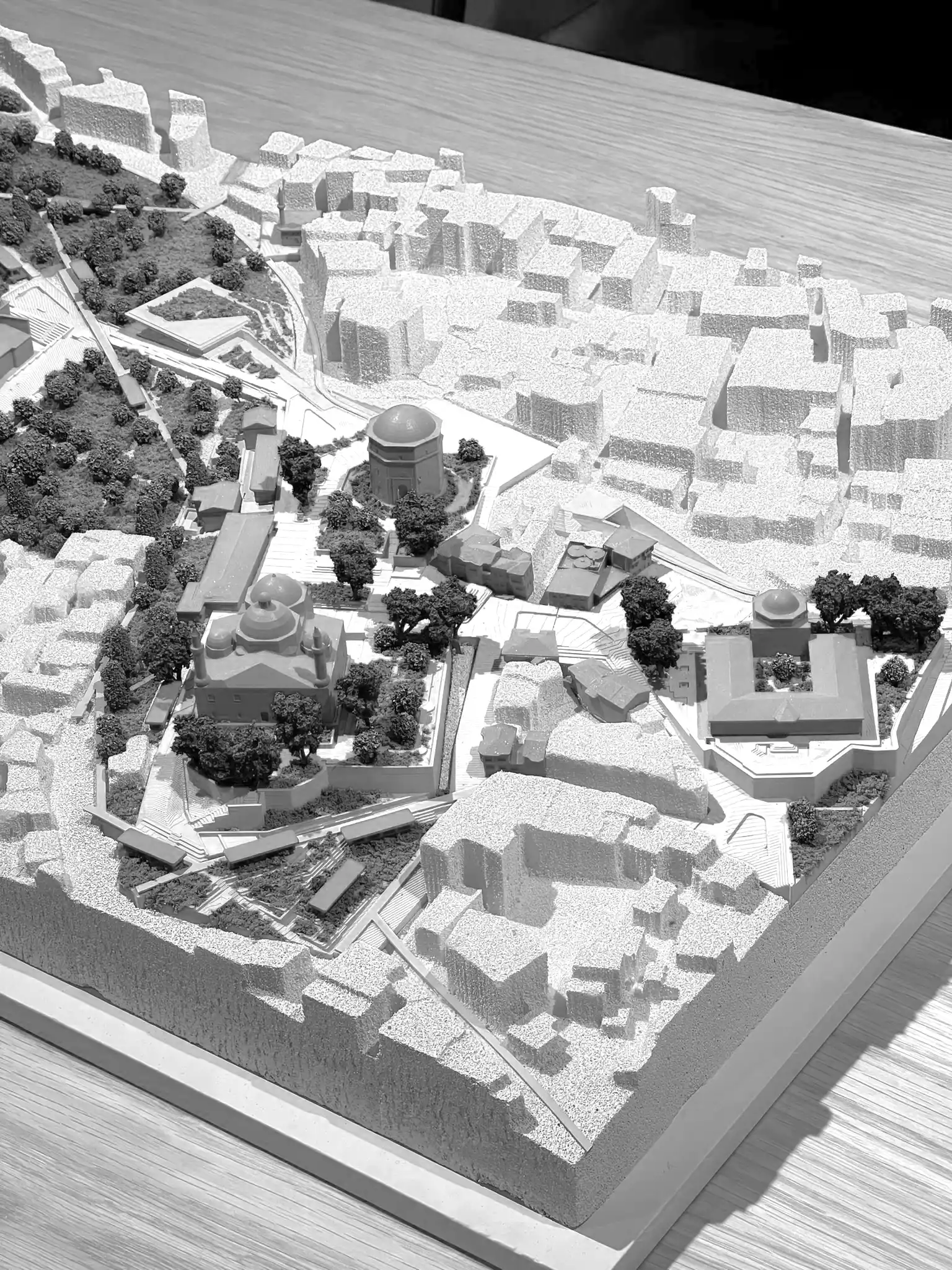
Model Images
Competition Panels